Climb the tallest peak (10,064 ft.) in Los Angeles county.
| Mount San Antonio (also known as Mount
Baldy) via Baldy Bowl trail Climb the tallest peak (10,064 ft.) in Los Angeles county. |
| Visable from all over
Los Angeles, Mt. Baldy is the tallest peak in the San Gabriel mountains
and in Los Angeles county. The panoramic view from the top is a must
for any serious Southland hiker. On a clear day like the one I hiked
in early November, you can see all the way to the Pacific Ocean and
the Channel Islands in the west, the Santa Monica and Los Padres mountains
and the southern Sierra to the north, far into the eastern deserts and
the San Bernardino range south. Although it's only 70 miles southeast
of LA, and near the popular Mt. Baldy ski area, the summit offers a
360 degree wilderness vista relatively unmarred by development, except
far below in the valley. Its namesake is its rocky, tree-free summit,
which wears a cap of snow from the first winter storms and in to spring,
providing a cooling alpine backdrop above the palm trees of sunny downtown
LA. Intrepid - and well outfitted - hikers climb to the summit year round.
Mt. Baldy straddles the Los Angeles and San Bernardino county line,
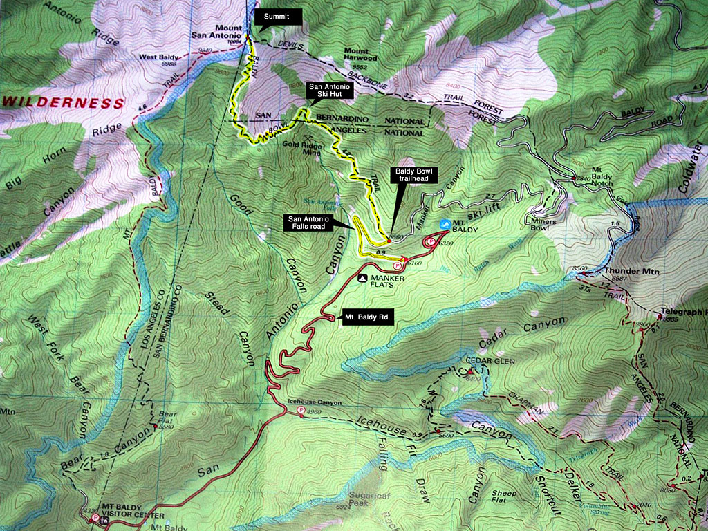
and also the San Bernardino and Angeles National Forests. Summiting via Baldy Bowl trail is a steep and strenuous workout. Plan on 3-4 hours up and about the same down. I recommend you have several vigorous workouts under your belt before you hike this trail. Some young guys I spoke with afterwards at the bottom told me it took them 6 hours to climb this trail. They'd gotten lost at one point, ran out of water and one had a bad altitude-sickness headache. This is a serious climb in a big wilderness area and not to be taken lightly.The San Antonio ski hut - a small wooden rest stop building a little more than an hour up - is a popular destination. The hut has benches and a great view, but is open only in ski season apparently. |
Another popular summit
trail that begins near the church in Mt. Baldy Village is the Mt. Baldy/Bear
Canyon trail. At 6.5 miles, it's longer, but reportedly less steep.
I'm told it takes 5-6 hours on average to summit on this trail. The
quickest way to summit is the Devils Backbone trail via the Mt. Baldy
ski area chair lifts, which run year round, but only on weekends off-season.
The lifts can take several hours off the climb but there is still over
3 miles to hike from the top of the second chair and a narrow path along
a steep dropoff to negotiate. The ridgeline segment can be daunting
in high wind or bad weather. You can take the lift down regardless of
whether you came up that way. With light traffic, Mt. Baldy is a 50 minute drive from LA, then another 20 up the mountain to the parking area. I hit the trailhead at 9am, elevation approx. 6100 feet, temperature a cool 50 degrees. The parking area was full of cars when I arrived at 8:45am so I knew there would be a bunch of peops on the mountain. Later, I passed at least 30-40 members of a group one at a time, spread out over a mile, all speaking Korean and well-outfitted for the steep hike up. Many were easily 60 years old. Some tough ladies. Some college age kids too. I wondered if they knew how steep this trail is and what they were getting in to... About 3 hours to the top, including a brief detour to check out the Ski hut.Coming down was rough on the knee joints and trekking poles were most welcome. |
| The Baldy Bowl trail
is a notoriously steep and strenuous climb of 5-6 miles, depending upon
whom you speak to. Despite the unmarked trailhead, (no sign, just a
cairn) it's well-maintained and relatively easy to follow, but a compass
and/or GPS will come in handy. In the steep miles between the San Antonio
Ski Hut and the summit, there are several opportunities to lose the
trail through rocky areas. I recommend you pay attention to where other
hikers are going ahead of you if possible, look for cairns and turn
around frequently to memorize the trail location for the return trip.
Above the Ski Hut, you'll navigate a steep drop-off, loose dirt and
scree areas on the switchbacks and scramble up some jagged rock formations.
Over all, it's a safe, non-technical hike to the top. The real danger
is in miss-steps from fatigue. The Baldy Bowl trail offers little to no view of the summit until you're minutes from the top, but you'll be too busy catching your breath to notice anyway! No hiking permit is required, but a Forest Adventure Pass is required to park in non-fee areas. |
For much of the year, there
is no water in the streams. In early November, there was just
a trickle or two across the trail, so plan on packing up all the water
you need. I'd recommend a minimum of 2 liters per person in the summer.
Weather here can change quickly, so do some research, check the forecasts and pack accordingly. This early-November trip had a cool morning and warm afternoon perfect for hiking. Following the first rains of the winter, there is new snow at higher elevations, but most of the trail stays clear and dry. After two or three storms, people often turn back from summit attempts because of ice, deep snow and ferocious winds.The summit is usually covered in snow from late November until early June. |
| STATISTICS |
| Mt. San Antonio (Mt. Baldy) via Baldy
Bowl trail Height: 10,064' Elevation gain:3900' Distance: 5-6 miles one way Duration: 3-4 hours one way Difficulty: Strenuous Water availability: A few trickles. Pack it in. |
| From the San Fernando
Valley in Los Angeles, take Hwy. 101 east to 134 east to 210 east, about
60 miles to the towns of Claremont / Upland. Fill up in town - there's
no gas on the mountain. I-210 through Claremont / Upland has only two
exits- N. Towne and Baseline Rd. I think N. Towne is more intuitive
to backtrack when you're returning late and tired. Exit N. Towne Ave. and T/L (north). T/R (east) on W. Baseline Rd and go about 2-2.5 mi. to N. Mills Ave. T/L (north) on N. Mills Ave. and go north 1.5 -2 miles to Mt. Baldy road. For the trip back, just stay on Mt. Baldy Rd. until it dead ends and T/L onto N. Mills (which goes straight south and over the 210, but has no ramp), remember to T/R on Baseline Rd., which runs parallel to the 210, then T/L at N. Towne and you're set. Go east up the mountain on Mt. Baldy road, past Mt. Baldy village. There's a turn or two in the residential area beyond the village where you'll need to pay attention to stay on Mt. Baldy Rd. After a few twisty miles up the mtn., look for the Manker Flats campground sign on the right. 100 yards past the campground on the left is San Antonio Falls road. There's a large gravel parking area on both sides of the road. You'll see the porta-toilets and the big yellow gate a little ways up the road. From town, it's 7 twisty miles to Mt. Baldy village and another few miles to Wanker (oops...Manker!) Flats. |
Walk through the gate
up San Antonio Falls road, which is paved the first 1/2 mile, then becomes
gravel after it cuts back steeply to the right. At this point, you can
see the falls from the road. In the spring, it's an impressive cascade.
Another 1/4 - 1/2 mile up the gravel road on the left, you'll see the
large cairn of rocks which marks the trailhead. There's no sign, so
pay attention or you'll miss it as the view to the right is riveting.
The US Forest Service requires you to buy an Adventure Pass ($5/day, $30/year) and display it on your dashboard when parked in a non-fee area. Leave nothing that looks valuable visable. No Wilderness Permit is required to summit Mt. Baldy, but you'll need one to hike in to some of the adjacent wilderness. Overnight camping is allowed on the summit, but no campfires. Mt. Baldy Sugar Pine Chair #1 lift is open year round on Sat-Sun for hikers, mountain bikers and tourists. Hours are 8-4:30, but last chair down until 5pm.It's $15 roundtrip, $10 uphill or $8 downhill. Parking is free for customers. See link below for more. |
||
|
|||
 Another beautiful Southland Saturday in autumn and a 60 mile drive beside the San Gabriel mountains southeast of LA on the 210 freeway to Claremont, CA. |
 Looking southwest back down the valley and Mt. Baldy road towards Mt. Baldy village. The trailhead begins a little less than 1 mile up gated San Antonio Falls road. You can see the falls from where the road becomes gravel. |
 Looking back down the gravel road, a few hundred yards shy of the trailhead. That's Baldy Bowl you see up there behind the tree. That's where you'll be going. It's about two hours to the top of the bowl, and an hour more to the summit. |
 The trailhead is marked with this cairn and easy to overlook because you're checking out the views to the right. Was there a sign? Maybe it got knocked down? These 4 darker shots I took late afternoon on the way out. |
 If there weren't some people going up here when I arrived, I would've missed this steep, narrow footpath and continued up the gravel road to who knows where... (The ski area , it turns out) |
 A trail register on a stand a few 100' up the trail lets you know you're on the right track.You can make out the green San Antonio Ski Hut above the middle right pine tree, at the base of Mt. Baldy bowl. |
|
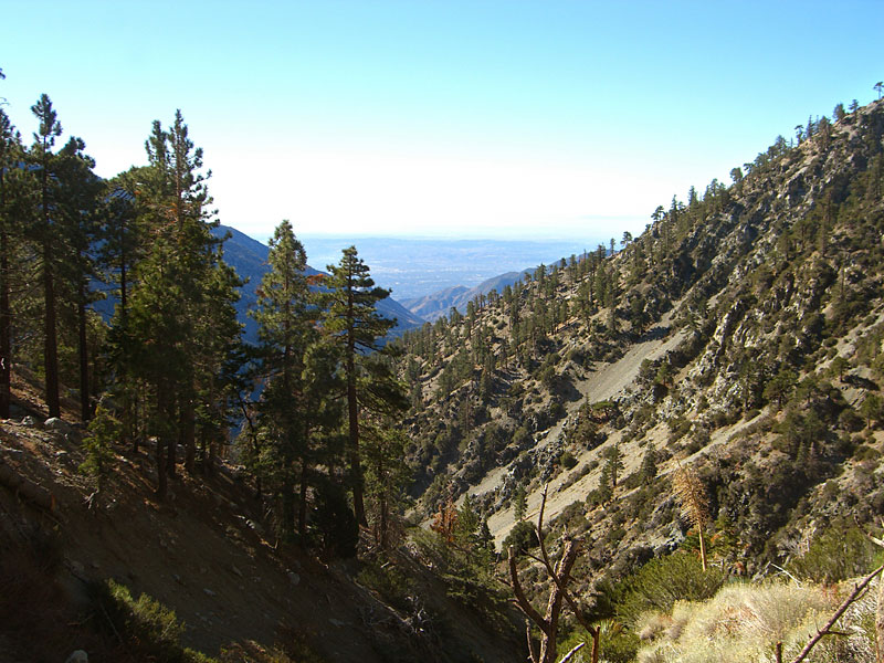 Looking west down the valley. |
 Baldy Bowl above the trees. You'll be on the top lefthand side of that bowl ridge soon. |
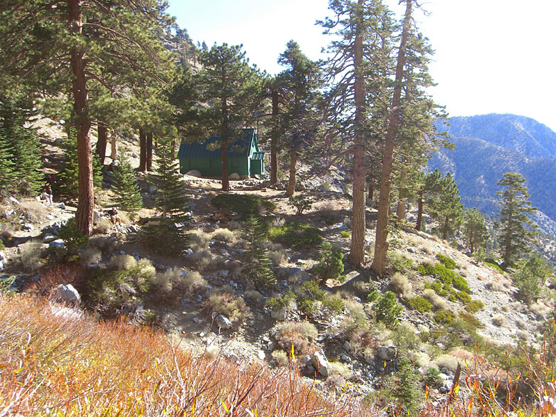 Took me a little over an hour to reach the San Antonio Ski Hut, closed for the season. This is as far as some people go. Others take a break on the benches before the big ascent. |
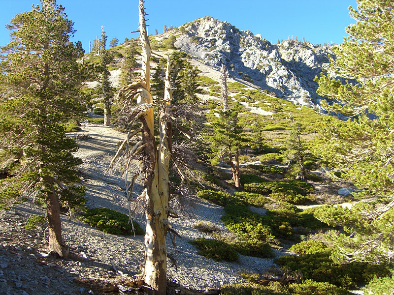
 After the hut, the trail gets steep and switchbacked through thick forest to a ridge along the top of Baldy Bowl, where the tree cover breaks. |
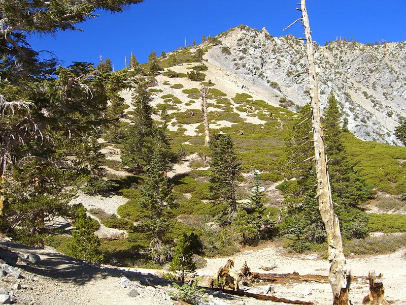 After you gain the ridge, then the top of this peak above Baldy Bowl, you still have an hour to go. And you thought you knew steep! Turn and memorize the way down from here. I'm told it's a place hikers often get lost. |
 Autumn has exceptionally clear days. The ocean and the islands were easily visable, although my camera doesn't capture it well. |
|
 The trail ascends through boulder fields, ancient forest and talus slopes before nearing the edge of treeline. |
 There are many steep drop-offs and rock formations to keep you on your toes. |
 Unlike some, this trail offers no view of the summit at all as you approach it, just an increasingly steep gravel slope. |
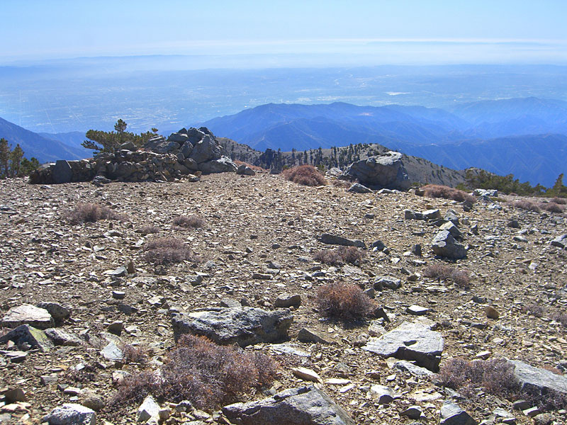
 Then finally, the summit, 3 hours after departure. |
 There were 30-40 people and a dog on top when I arrived. And the 30-40 people I passed on the way up would be arriving before long. |
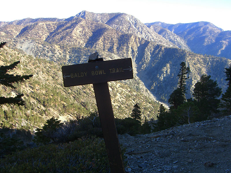
 I escaped to the eastern side for my break. This southern vista shows that the San Bernardino mountains in the distance have have several peaks taller than Mt.Baldy. Going there next weekend. |
|
|
|
 Rocks on eastside of summit make a great perch for a lunch break. |
|||||
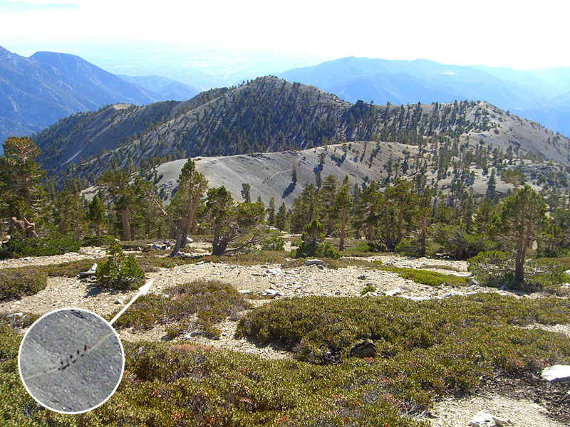
 Mt. Baldy has 2 summits. This second, northwestern summit blocks the view to downtown LA. It's called West Baldy. |
 Even though it just a 10 minute hike from Mt. Baldy summit, I could see there was nobody on W, Baldy, so I hiked over to escape the crowds. |
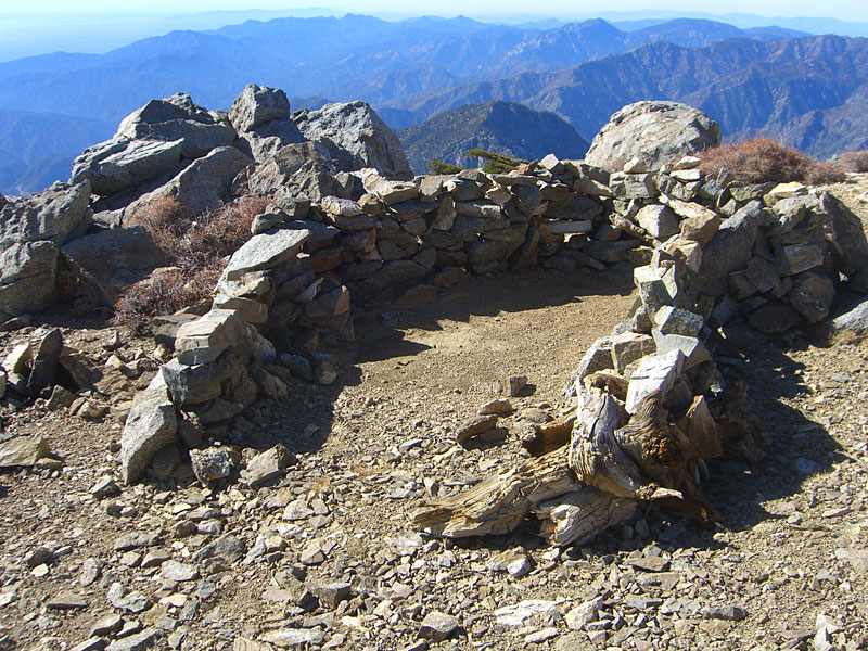 Someone put together this shelter just so I could take a welcome nap on the soft dirt floor. |
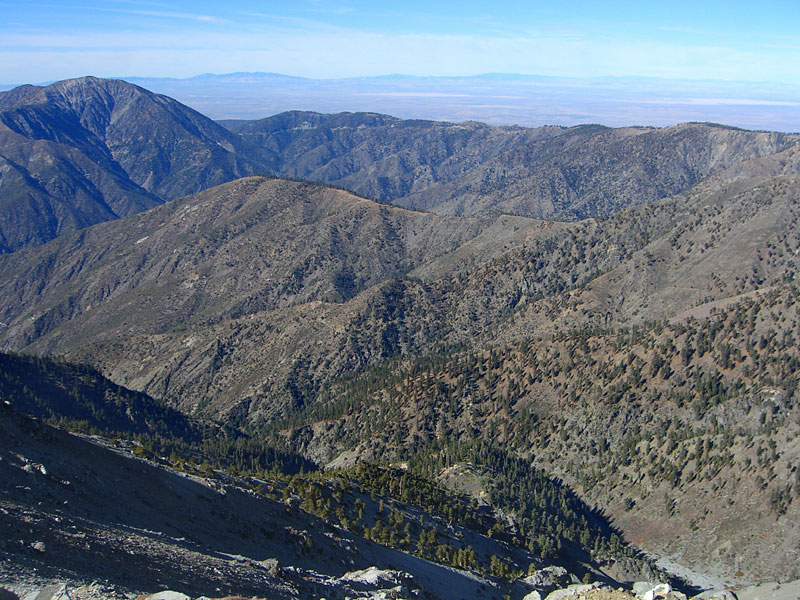 Vista north from W. Baldy to the Los Padres and snow covered southern Sierra ranges. |
 From the W. Baldy, it was clear enough to see the buildings of downtown LA and Century City, the ocean and the islands, although my camera doesn't capture it. |
 This group was coming up the Mt. Baldy trail that begins by the church in the Village.Thought I'd intercept them on my way down and ask about their experience on that trail. |
|
 Started down cross-country from W. Baldy towards main trail across the gulley. This is the only pic I could get of Mt. Baldy summit, the crowd visable on top. |
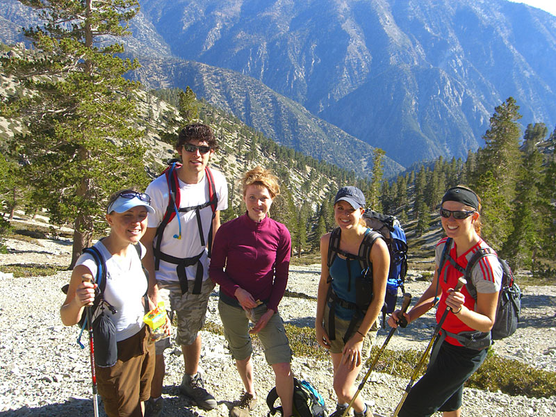 These hikers, from the previous pic, were from the San Bernardino area. Their summit route was taking 6 hours! I gave their cute, tired little dog some water - poor thing probably would've stayed home had he known what they were planning! |
 Didn't want to take their long route back or climb back to the summit to regain the Baldy Bowl trail, so I traversed cross-country half a kilometer through dense thickets. |
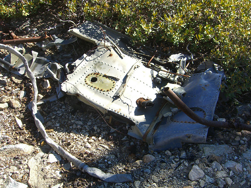 That's where I stumbled across a wrecked airplane, the debris field scattered throughout this deep sage thicket on a steep off-trail slope. I could tell it was old by the engine. I was way off the trail and at the time, thought maybe no one knew it was here. |
 Later I found that planes crashed into Mt. Baldy regularly, including two WW2 era Hellcat fighters and a C-46 transport in the forties and numerous small planes since, usually during bad weather. Other parts were visable from the trail. Google Mt. Baldy plane crash for more. |
 |
|
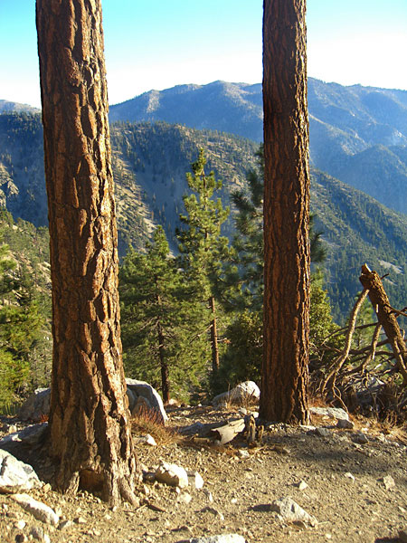
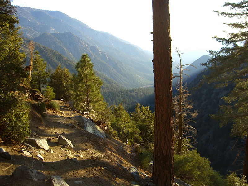
 On the trail down, the view was inspiring. |
 |
 Moon over the San Bernardino range in the far distance. |
 This was a steep mountain to climb, but the descent really made my knee joints ache. |
 Even dying, this giant twisty tree has a lot of coiled tension - beware! Look for it on the switchbacks beside Baldy bowl. |
 This sign at a junction is confusing. Didn't notice it coming up.You want to go down to get out, not left, which would have to dead end into the middle of Baldy Bowl. I think it's just rotated wrong. |
|
 The impressive Mt. Baldy bowl. Want to hit it on my snowboard some day. |
 |
 A good picture of the degree of incline over much of this hike. |
 The steep descent follows the sun down. |
 |
 It was a warm and perfect day for a hike. It wasn't anywhere near as hazy as the limited exposures of my camera suggest. |
|
 |
 . . |
 Nice sunset over Upland on the drive out |
||||
Since
Jan.09
|
||||||

