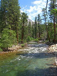
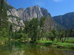
Grand Canyon of the Tuolumne River

View Grand Canyon of the Tuolumne River in a larger map
Grand Canyon of the Tuolumne RiverYosemite National Park, CaliforniaJuly 16-19, 2009
3 days along a wilderness river full of spectacular waterfalls


Overview
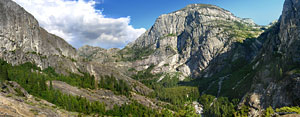
If you like untamed mountain rivers, magnificent waterfalls, towering granite peaks, lots of warm sunshine—and oh yeah, solitude—then this is an unsurpassed Sierra hike to experience. The Grand Canyon of the Tuolumne (pronounced too all' um ee) River is 30 miles of backcountry wilderness that slices down through the northern High Sierra of Yosemite National Park from east to west. An impressively engineered and well-maintained trail through this rugged canyon follows the river as it flows below towering peaks, between sheer granite canyon walls, and through ancient forests. In the 30 miles from Tuolumne Meadows to Hetch Hetchy valley, the river passes through a variety of topography and drops over 3000 feet, encompassing many moods and characteristics. At times, it flows wide and lazy and relaxed, trout leaping from emerald pools in the shade of immense pine trees. In narrow, steeper sections, it becomes a raging torrent of violent whitewater power, launching over steep cliffs, pounding channels through granite chutes, pumping millions of gallons of snow melt over spectacular spray-shrouded waterfalls. Always, majestic peaks tower above, astounding vertical curtains of granite. Although there is a deep gorge midway and walls of granite mountains too steep to hike over much of its length, the Grand Canyon of the Tuolumne isn't a sunken canyon like the Grand Canyon in Arizona. It was carved by glaciers, not erosion.

Bears and deer are seen here regularly, along with marmots and rattlesnakes and a host of forest animals and birds. Rarely seen are resident mountain goats and cougars. Mosquitoes can be fierce from early Spring to mid-Summer.

The trail crosses back and forth over the river on numerous wooden and steel bridges, but the majority of its length is on the north side. In the middle of the journey, the path circumnavigates deep Muir Gorge, where sheer canyon walls rise up 1500 feet directly from the river bank, requiring a strenuous reroute up an adjacent mountain and down again. At the western terminus, the dammed Hetch Hetchy valley is a large reservoir that is the water supply for the Bay Area.
Hike East or West?
From either direction, the Grand Canyon of the Tuolumne River trail is a workout and you'll need to be in good shape to enjoy it. The western end of the trail is White Wolf Resort and campground, 3000+ ft. up an extremely steep mountain trail from the river level. If you start at White Wolf lodge/campground and hike east, there is a 4 mile descent through thick forest on fire roads to the trail, then you hike down, down, down (hope you've got good knees) to the river and spend the next 30 miles slowly ascending to Tuolumne Meadows.

If you start at Tuolumne Meadows and hike west, you slowly (sometimes very steeply) drop the 3000+ feet in 3 days, then ascend the strenuous, exposed, awesomely-steep mountain to White Wolf all at once - over 3000 feet of it in just 2 miles - an infamously grueling, relationship-ending brute of a climb, especially in the hot sun.

Although there are several access trailheads on which to begin this hike from the east, the main one is Glen Aulin trailhead in Tuolumne Meadows, at a similar altitude as White Wolf. The Glen Aulin trailhead begins from the Lembert Dome parking road. Glen Aulin (Gaelic for beautiful valley) is a spot about 4 miles west of the trailhead along the Tuolumne River below a large waterfall where a tributary stream flows in and the Park Service operates a High Sierra Camp (HSC). Each of the 5 seasonal HSC's throughout Yosemite offer large canvas walk-in dormitory-style tents with cots that cater to families, groups and those who want to get out in the wilderness without roughing it. A variety of well appointed breakfast and dinner meals are included.

I do the hike from east to west, starting in Tuolumne Meadows and descending for 3 days, then toughing out the big, bad hill at the end of the hike, when my food is nearly gone and my pack lighter.

Trip Report

A fellow hiker recommended Grand Canyon of the Tuolumne on one of my 2008 Yosemite trips and after some research, I plan on hiking it the following summer. I get my permit reservation online several months in advance and spend some quality time getting in shape for the trip. In the days leading up to my trip, I check on the Yosemite website regularly. A large, lightning-sparked wildfire in the Harden Lake area - north of White Wolf atop the west end of the canyon - has been burning several weeks, but is supposedly 95% contained. I have tentative plans to camp the last night near there - I'll have to play it by ear. On the phone the day before I drive up, a ranger assures me there is no lingering smoky haze over the High Sierra, much to my relief. According to the National Weather Service, the weather looks like it will cooperate too. That reduces my concerns to just mosquitoes—which this time of year are always an issue—rattlesnakes, bears and mountain lions. I pack supplies for 4 days to hike the 35 miles, allowing plenty of time to wander and explore places that interest me.

I break in my new Gossamer Gear Mariposa Plus lightweight backpack (1lb., 8 oz.) on this trip. The full pack with 2 liters of water, 4 days of food, a bear can, and gear weighs in at 23.5 pounds. A Tom Harrison Yosemite topo map keeps me situated. I took lots of video and will put some clips online when I learn how to do it right.

Wednesday July 15 - Driving In
I leave work early, at 3:00, for the 300 mile, 4.5 hour drive from Los Angeles to the south Yosemite entrance and drive straight through the park to Tuolumne Meadows campground in the northeast, another 75 minutes. I stop just to eat and to fill up outside the parks over-priced gas. Just beyond Tenaya Lake on Tioga Road, I see in my headlights an eighth mile ahead what appears to be a cougar crossing the road in the distance. The size, color and distinctive amble make me think it isn't big enough to be a bear, but it's dark and I can't see it that well. Was it a wolverine? It's after 9:30 when I reach the large, sprawling Tuolumne Meadows campground. It's very dark and most everyone's turned in. After some confusion, I locate the walk-in backpackers campground, where backpackers with Wilderness Permits can stay for $5/night, but don't know where I'm supposed to park. Later, I find that backpackers are required to park on the road beside Lembert Dome parking lot 1/4 mi. away and walk in. But since it's late and everyone's asleep, I find an unused campsite in the car camping area and lay out my sleeping bag on a groundsheet near the car. If someone comes along and asks, I'll get up and move. Not long after I settle in, a guy in the camp next door starts shouting "Hey! Get out of here!" I turn my light on and there is a large cinnamon colored bear strolling through the campground not 100 feet away. The temperature drops down in to the low forties this first night and I'm glad I have my new 25 degree down bag.

Day 1: Tuolumne Meadows, Tuolumne Falls, Glen Aulin, LeConte Falls, Waterwheel Falls 12 mi., -1700 ft.
I get up about 7:00am to clear skies and cold temperatures and have a quick breakfast in a swarm of hungry mosquitoes - a condition I'll be getting used to the next few days - then drive the mile from Tuolumne Meadows campground to the Wilderness Permit station to pick up my permit. The ranger checks off the things I am agreeing to or risk a fine: Bear-proof food can - Got one. Camp 100 ft. from water - Check. Pack out used toilet paper in bear can. Yuk! Critters have been digging up toilet paper and making nasty scenes, and people haven't been burning it thoroughly, apparently. Keeping used TP in my food can isn't something I'm looking forward to, to say the least, but neither is attracting unwanted animals. I drive the short distance to Lembert Dome and out the dirt road beside the parking lot to the Glen Aulin trailhead. On this weekday morning, there are only a handful of cars and I can park right near the trailhead.

I set off walking across awesome Tuolumne Meadows at 9:00 on a cool, beautiful morning under a luminous blue,
A pair of bucks enjoy a morning meal of wet green shoots
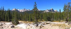
cloudless sky. This meadow is so lush and verdant that the first time I saw it, it seemed that it surely must be man-made, like a manicured country club or golf course. 12,000 foot Mt. Dana and bulbous Lembert Dome dominate the eastern skyline. To the south, several domes and the jagged spires of Cathedral Peak accent the flatness of the giant open space, the largest alpine meadow in the continental USA. Through the center of the meadow, the Tuolumne River meanders like a snake, gliding tranquilly through the grassy plain with easy grace and understated power, ready to explode in whitewater fury at the first big elevation drop. Her waters are sparkling and clear, lined with smooth, brown stones, and rarely more than 3 feet deep and 100 feet wide.

Double bridge east of Tuolumne Falls
Double bridge east of
Tuolumne Falls
The Glen Aulin trail starts as a fire road and quickly becomes a footpath. A warm breeze carries the fragrance of pine and wildflowers and meadow grass. Large furry marmots play on logs and the air is filled with birdsong. Just across the river bank, a pair of bucks enjoy a morning meal of wet green shoots. The first few trail miles follow the rolling water through tall pine forests below rounded peaks and across fields of smooth granite covered with pine needles, always accompanied
The river drops slowly at first. Then come some big falls.
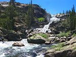
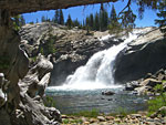
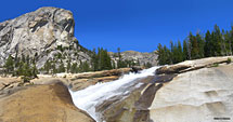
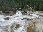
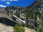
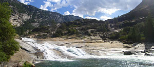
by the gurgling and splashing riversound. Several bridges put the trail on one side of the river, then the other. I see only a few other people. The river drops slowly at first in a series of playful cascades. Then come some energetic big drop waterfalls where the river is compressed into narrow channels, leaping over cliffs and swirling around tumbles of giant boulders. The biggest, Tuolumne Falls, drops over 200 feet through a series of roiling whitewater cascades and pools. After each fall, the river widens and slows and catches its breath for the next drop. The trail winds around rocks and giant trees, sometimes along, sometimes above, sometimes out of sight of the river.

Glen Aulin
As I get closer to Glen Aulin, I cross paths with several dozen people going in and out, mostly dayhikers, but some distance backpackers too. Although it's only Thursday, it's the start of the milder part of the summer when the snowed-in mountain passes finally have enough sun to melt and all the trails in the park are open. I pass several horses and heavily-laden mules packed with provisions. (And a trail of manure to follow) The trail crosses a bridge to the north side of the river at Glen Aulin and a second bridge crosses over a tributary to access the camp. After Glen Aulin, only a few dayhikers are on the trail and then miles go by without seeing anyone.
Glen Aulin Falls
Glen Aulin Falls
Following the trail at a relaxing pace, I find a shady spot on the water for lunch and to read a chapter of my book - John Muir's My First Summer in the Sierra, a diary of his 1869 trip to Yosemite as a sheephand assisting the drive of thousands of sheep to high Sierra pastures, a book that wasn't released until late in his life. Yosemite was already a popular tourist destination for well-heeled adventurers when he arrived. His rhapsodic, botanistic enthusiasm gets a little flowery at times, but his sense of humor comes through when he describes his disdain for and eventual loathing of the sheep, which trample and devour, ensmegmate (a word I invented) and ruin meadows. At a difficult crossing of Yosemite Creek, he enjoys fantasizing about one stubborn sheep that would have the distinct privilege of being the first mutton washed over the edge of the highest waterfall in the land.

LeConte Falls
The day has been very hot, possibly 100 degrees. By mid-afternoon, after 10-11 miles of incessant descent, I round a bend and arrive atop LeConte Falls, arguably the most impressive of all the Tuolumne's cascades. The river is wide when it plunges
I spend a couple of hours exploring and relaxing at epic LeConte Falls
I spend a couple of hours
exploring and relaxing at
epic LeConte Falls
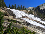
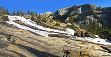
over the long, sloped granite embankment that is LeConte Falls, picking up speed and pressure, pounding into obstacles and pits and spraying voluminous, rollicking plumes of white water high into the air. These vertical plumes fall back on themselves in a motion that could be interpreted as a water wheel. LeConte has several water wheels and at the time of the trip, I assumed it was Waterwheel Falls, only to discover the correct name later after some research. Exploring the densely wooded, wet and rocky area atop of the falls for a campsite, there are a few flat spots on some high rocks with great views, but it's windy here and too exposed should the weather take a turn for the worse. Paralleling the length of the falls, the trail descends through dense overgrowth and boulders. There's no clear path to the water, so you have to pick a spot to climb through tangles of shrubs if you want to get near the falls. I have a quick look then continue down the steep trail to find a campsite. About 3/4 mile down the canyon through the overgrowth, the terrain levels out above another spectacular plunge of rushing white water - Waterwheel Falls - and I find an established site in the woods with a nice stack of fire wood ready to use.

After setting up camp and securing my food, I climb back up to LeConte Falls and spend the late afternoon exploring the rocks and the river, taking photos and videos and marveling at the spectacle of tons of thundering whitewater surging relentlessly down the granite slope. I'm in awe that I have this sensational wonder of nature entirely to myself. I clamber over and around an island of large boulders at the base of the falls seeking access to the other side of the river and the biggest waterwheel, but after 10 minutes of climbing, discover there is no way across without plunging into the icy, fast-moving water. A brilliantly colored kingsnake relaxing atop a boulder doesn't appear concerned that I may step on him to gain the next foothold, but I manage to clamber around him.

Back at camp in the woods above Waterwheel Falls, my bug headnet becomes the most essential piece of gear, as big, hungry mosquitoes are swarming with suicidal abandon, defying insect repellent, constant swatting and even the smoky campfire to get my blood. Many bite warriors are lost in the attack. Many persistant and highly skilled flyers are successful. That night, I sleep out on the large, smooth granite platform at the top of the falls below my camp, observing satellites traversing the billions of stars and listening to the thunder of water below before drifting off. Before dawn,the temperature drops and the wind picks up enough to wake me up but I stay warm and cozy in my down bag.

Day 2: Waterwheel Falls, Muir Gorge, Pate Valley 11 mi., +900 / -1600 ft.
Zen moment, morning of day 2 beside Waterwheel Falls
The day dawns sunny and clear on my stone plateau next to a giant roaring waterfall above my very own immense and spectacular wilderness canyon. I sleep in late, letting the sun warm the cool air, and after breakfast, greet several pairs of hikers coming through, admiring the magnificent falls and vista westward. I spend the morning climbing and exploring the rock formations around the similarly magnificent Waterwheel Falls, then find a shady spot to relax and read by the water, trying to ignore the procession of black ants exploring my clothes. No matter where you sit in the Sierra, you always seem to be in the middle of some major ant thoroughfare.

Back at the campsite for lunch, I hear several loud dull pops, like the sound a fluttering sail makes when it suddenly catches a big puff of wind. It seems to come from the direction of my tent on the other side of some bushes from the fire pit kitchen. I look around but can't place the origin of the peculiar noise - it isn't windy enough for the tent to be flapping and catching that much air. Minutes later, as I'm packing, I hear it again. Then I look inside my tent, which has been in the hot sun several hours now, and find that several baffled chambers in my fully inflated air pad have become over-inflated by the heat and have begun popping. Now my brand new, expensive, ultralight air mattress has a large basketball-sized bulge in it. I should have known better - the instructions I didn't bother to read were clear about this, but there's a first time for everything. I'd have to deal with trying to sleep on it for the next two nights, regardless. The lesson here: never leave your air mattress fully inflated on a hot day.

The path follows the burbling music of the river. What wondrous scene will unfold around the next bend?
Looking west from this waterfall campsite, which is about 12 miles west of my entry trailhead, the canyon drops
Ranks of towering peaks line the canyon
Ranks of towering peaks
line the canyon
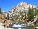
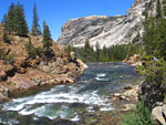
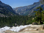
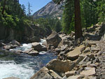
down dramatically, filled with rushing water and giant boulders, lined with huge pine trees. Following the river, big mountains rise above steep canyon walls. After a relaxing morning, I'm packed up and on the trail at 1:30 and it's very hot - probably 100 degrees again, but the moist air from the river and a constant breeze blowing down the canyon cool things off to a moderate temperature. I walk along awestruck at the height of the mountains towering above this lush wilderness, at the building-sized massiveness of the giant boulders which break off and tumble randomly into permanent anchorages here and there along the trail, at the emerald green of the splashing water, anxiously anticipating what wondrous scene will unfold around the next bend. From my campsite at the last big waterfall, the trail winds down the mountain above the river to water level again.

Just west of a tributary called Return Creek, where there is a wooden bridge and a large campsite, a bend in the canyon reveals a sparkling cascade-fed natural swimming hole where there are flat rocks to sunbathe on and a wide, deep emerald pool to beckon the overheated traveler. I hadn't been hiking long enough to stop for an icy swim break, so I reluctantly pass it by after scoping it out for several long, tempting moments.

Rattler close call
As I continue west through the shaded forest areas, blood-thirsty mosquitoes attack en masse, flying into eyes, nose, mouth
My rattler close call. The orange dots are my trek pole plants. My next footstep would have been directly on top of it.
- anything warm and wet. At one point, I get distracted enough from my usual careful and attentive foot placement that I come perilously close to stepping on a large rattlesnake as I pass over a bend in the trail where a cutup tree fills a ditch. I see it coiled and asleep directly underfoot a split second before I'm about to put my full weight down in that exact spot. I instinctively lurch away and throw the tip of my trek pole towards the spot and use it to vault myself away from the camouflaged serpent. The pole tip lands directly in the exact spot intended and I have the perfect leverage to push directly away from the snake before it can react, jerking my leg up as the thing springs to life, rattling loudly. I must have jumped five feet away in that one split second move! The snake disappears quickly into the rocks as I turn back to see exactly what just happened. It shot off so fast that I don't think my pole even touched it, so we both avoided an unpleasant incident. These Western Diamondbacks are so well camouflaged as to be almost invisible. Only the unique spiral shape of their coiled body contrasts from the trail and the forest floor as a warning. It's then that I recall the hiker who suggested this trip also mentioned a plethora of near-invisable rattlers he encountered here. They're all over the Sierra, but rarely seen, so it's easy to let your guard down. If I didn't have trek poles, my forward momentum was such that I would have been unable to avoid stepping directly on it, probably suffering a painful, trip-ruining bite with a day and a half hike out - a distinct lesson in favor of poles. It scares the bejesus out of me and I start paying more attention after that - mosquitoes be damned!

Muir Gorge
Glacial carving is evident in the smooth canyon walls

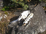
A sun-bleached skull placed on a rock beside the trail. Deer?
Towards late afternoon, I arrive at the eastern side of a section of trail that leads away from the river and climbs up and over the impassable Muir Gorge area. Through a thick forest and up the steep portage,
Into the Pate Valley
the mosquitoes are lying in wait again. At the summit of the exhausting reroute, the forest clears to rounded granite and I get off the path and climb to the top of this bypass mountain for a birds eye view of the formidable canyon far below. No river trail can traverse the steep walls of the Muir Gorge, where whitewater rapids carve through vertical granite. Unfortunately, there is little view to be had of the magnificent gorge itself, save from the air, because of its distance from the trail and because it's hidden behind the mountains the trail traverses. The western side of Muir Gorge bypass is an extremely steep series of exposed switchbacks. Several east-bound hikers are struggling up it in the heat of the afternoon sun, including one heavily laden fellow in questionable physical condition who is having a difficult time. Towards the base of the switchbacks, a beautiful little waterfall from a tributary stream catches the sunlight in a hidden cove, marked by another wooden bridge. Then, slowly, the trail drops to its place beside the river in a section known as Pate Valley and I hike until the light starts fading.

Just below the pool of a wide and noisy cascade in an open part of the canyon, I find a perfect campsite in the woods beside the river.
I decide to wait until after dusk to start dinner to diminish the onslaught of mosquitoes. I gather and cut some wood, and then take a break in my tent, emerging at dark. I have a nice fire going to cook dinner by, then enjoy a big cup of hot chocolate, sitting in an open area listening to the waterfall, trying to identify major constellations - difficult to detect in the billions of stars one can only see away from the city lights in the backcountry wilderness.
Day 3: Last day on the river and climbing to White Wolf 12 mi., +3600 / -800 ft.
That temperature drops dramatically in the early hours and my thermometer shows 32 degrees when I climb out of the tent in the morning. My sleeping bag gets wet from the condensation. Sporadic clouds have blown in overnight but clear off quickly. After breakfast, I pack up while thwarting mosquitoes and I'm
Another beautiful morning along this wilderness river. Bridge in Pate Valley.
on the trail by 9. Checking my map, I realize I can probably hike out today but hope to camp another night along the river before ascending the grueling White Wolf switchbacks, or possibly at Harden Lake at the top. Another beautiful morning along this wilderness river, discovering new cascades, mountain tops, rock formations and flora with the same sense of wonder that the first traveler here must have experienced, except that I have a well-maintained trail to follow and a pack full of high-tech gear. After a mile, I have to maneuver around a recent and significant rockfall that blocks the path with truck-sized boulders. Then the trail wanders away from the constant gurgling water sound and enters a lush primordial forest with big ferns, tall grass and brilliantly-colored flowers, beams of sunlight flickering through the canopy of giant trees. Along with the moist greenery is plenty of mud and more hungry insects to avoid. Just before it swings out of the forest and back to the river, the trail intersects with the Pleasant Valley trail, which climbs into Yosemite's remote northeast wilderness. After two wooden bridge crossings, the trail rises higher above the river to avoid badly eroded banks. I check my topo and see that I'm close to an area of ascent, so I stop for lunch at a well-hidden camp, filter some water and cool off.

The climb to White Wolf
Shortly after the break, I'm already climbing the early part of the end of the riverside trail. I've underestimated how far I've come, so I'm hoping I'll drop back down to the river once more and find a campsite. As the trail grows
Am I going to have climb all the way up there to get out? (Answer: yes) and more!
Am I going to have climb all the way up there to get out?
(Answer: yes) and more!
steeper, I'm thinking, "Whatever this feature that's preventing this trail from continuing along the nice flat river is, it better be good!". Before I know it, I'm fully engaged in the final steep ascent out of the canyon, much sooner than I'd anticipated. Through the woods above, I can see that the direction of the trail is going south up to incredibly tall peaks, thousands of feet above the river bed. It's intimidating to think that I will have to climb all the way up there to get out. I say farewell to the river and my hopes of a last campsite on its banks. The trail gains altitude and then turns up the mountain dramatically in a series of switchbacks, leveling off at a serene lake, then switchbacking up again. These switchbacks are brutal - steeper and longer than the Mist Trail out of Happy Isles to Nevada Falls - and not steps but just incline and grade to climb. Overtaking two separate pairs of sweating, red-faced guys with large, heavy packs who were clearly struggling up the grade, I'm glad I've been training hard for this hike and have been aggressively reducing my pack weight with new equipment. It's mid-afternoon, and the sun is baking us in the high nineties, even 100 degrees. But the higher I climb, the more expansive and magnificent is the view of the surrounding mountains and the river far below, bulbous white cumulus clouds accenting the deep blue sky.

After an hour, a welcome crossing of Morrison Creek, high on the mountain, offers a perfect shady spot to bag up some agua and cool off my aching dogs in the cold stream. As I finish my break, the two other pairs of hikers drag themselves to the creek crossing and start unloading for their break. Although we exchanged greetings back on the trail, now, through a veil of exhaustion, no one says anything and we go about the business of cooling down and re-hydrating like soldiers during a lull in the battle. One of them looks to be on the verge of sunstroke - and this is only halfway up. And we do this for "fun". The next section is the hardest yet - ramps dynamited into sheer cliff faces,
extremely steep and
The trail leaves the Tuolumne before Hetch Hetchy and climbs straight up the mountain
challenging, but an amazing feat of trail-building. I wonder how the trail's chief engineer came to his decision to build a trail up this particular section of steep cliff-edged mountainside.

Hetch Hetchy
Just beyond the halfway point, I follow a small off-shoot trail to a panoramic cliff-top view west to the Hetch Hetchy valley and reservoir sparkling in the sunshine far below. The wind gusts are fierce on this high cliff. I can see how nice Hetch Hetchy must have been before they dammed and flooded it, a deep canyon lined with big granite domes and distinct peaks. John Muir fought the dam unsuccessfully for years, one of the his last great battles to preserve the wilderness with the Sierra Club. There is growing momentum to relocate the reservoir out of the national park and restore Hetch Hetchy valley. Far to the east are the peaks above Tuolumne Meadows where I started and far below, the river that has been my companion for the last few days.

The trail continues up through aspen-filled meadows of colorful flowers, up through tall, shady conifer forests, up through more switchbacks, up through wet, reedy grasslands, up through swampy, mosquito-infested wetlands, always up, up, up. Throughout the long afternoon climb, only a handful of backpackers are coming the other direction. Finally, atop the plateau at last, there is Harden Lake, which I'd considered as my
Smoldering fire near Harden Lake
last nights camp back in the planning stage. That Permit Ranger described it accurately a few days earlier as marshy with reed-covered banks, which negates good campsites. In addition, the smell of smoke from the still smoldering fire in the area was pervasive when the wind changed directions, so camping in this area was out. It is 4:45 and three miles climb up the fire road to White Wolf, where I can catch the only YARTS bus of the day, at 6:00, back to my car in Tuolumne Meadows 30 miles away. Popular White Wolf campground is perpetually full in season so I can't stay there and it's 6 miles to Lukens Lake, a backup site. I'm exhausted from the brutal ascent. Can I make the 3 mile climb to White Wolf in an hour? Despite all day of hiking in the heat, and the grueling, strenuous trek up the switchbacks, I tap into core reserves, put myself into high gear and double-time it up the long fire road to White Wolf lodge. Along the way, I pass blackened groves of big pines, still smoldering, beams of late afternoon
White Wolf Lodge
White Wolf Lodge
sun filtering through the canopy like headlights in fog.

White Wolf
In 50 minutes, I hike the last 3 miles up the mountain to White Wolf and have plenty of time to look around, buy snacks at the store and relax. White Wolf Lodge is a simple, low-key place with a restaurant, a closet-sized store and amenities for the tourists, who stay in the many rustic cabins scattered about. There's also a campground and several trailheads to nearby lakes. The fire road to Harden Lake is closed to private vehicles. Clean, well-dressed tourists stare at me as I board the large, crowded, touring-style bus. I realize that I'm probably pretty grimy-looking after 3 sweaty, unshaven days of hiking and breathing trail dust and sink conspicuously into a plush, clean seat. Vocal groups are having loud discussions, the driver is announcing sights over the loudspeaker and children are arguing. Welcome back to civilization.

Back at the Glen Aulin trailhead, my car is unrecognizable with dust from all the cars that now fill every spot on the dirt parking road. Hundreds of them. It's the weekend. I walk right by it without recognizing it and have to double back. Once again, I set out for the backpackers campground at the Toulumne Meadows Campground, much easier to find in the daylight. After a mosquito-filled tent set up and dinner, I chat with some neighbor hikers who have spent a week on the John Muir trail, then finish off the evening at the campground amphitheater where a ranger is giving a Park history/ nature talk around a bonfire.

Day 4: Valley visit, drive out
In the morning, I drive down to Yosemite Valley for my traditional last day big breakfast at Yosemite Lodge. Then once again rent a bike and ride around the entire valley in the morning sunshine listening to my iPod at full volume, smiling at everyone, marveling at the incredible meadows, mountains and waterfalls that never fail to provide awe. No matter what jaded old-timers might say about the overcrowded valley, it's still a magical place of astonishing beauty and there are many places to find refuge and solitude for those who seek it. I ride up to very popular Mirror Lake below Halfdome, find a quiet, shady spot where I can hang my feet in the water and read a few chapters of John Muir. Five hours later, I'm back in LA, washing off the dirt and planning my next Yosemite hike.
The Merced River and Yosemite Falls
Part of Mirror Lake
Part of Mirror Lake
Mirror Lake under Halfdome
A wader in the Merced and North Dome
Trail / Conditions / Info / Maps
The Grand Canyon of the Tuolumne trail is a well-maintained, mostly hard-pack dirt trail. Depending on which direction you hike, east-west
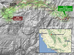
Trail map of Grand Canyon of the Tuolumne hike in Yosemite National Park, CA
or west-east, you'll be hiking down the whole trip or hiking up the whole trip. Although extremely steep in places, the trail is not dangerous and takes no special skills. You should be in good physical condition, drink plenty of (filtered) water and be aware of the dangers of bears, rattlesnakes (see day 2 of my trip report), mountain lions and heat stroke. The granite around the falls can be slick and the water is icy cold year round.

When to go
The highway to Tuolumne Meadows - Tioga Rd./Hwy 120 - is closed in the winter after the first storms and doesn't open until the last storms of the season have passed, sometimes as late as June. The ideal time to hike is July-September, but overnight temperatures can drop below freezing even in the Summer. Mosquitoes are swarming from late Spring through mid Summer, then mostly disappear.

Cautions
Like you, rattlesnakes love it here. When climbing rocks, never put your hand in a place you can't see and pay attention to where you're stepping at all times. Check for ticks on your clothes after you pass through overgrowth and learn to recognize poison oak.

Stock
The Sierra has a long history of use by stock and you may have to share the trail with horses and mules at anytime. You're supposed to move downhill of the trail when they pass and stand still - some of them get nervous around backpacks and trek poles.
Bears
You're required to remove all food from your parked vehicle—and whenever it's not within arms reach—and place it in provided steel bear boxes. It's a federal
law. "Food" includes all food and drinks, regardless of packaging, along with trash, toiletries, and other scented items. If a ranger sees "food" in your parked vehicle, you can get a whopping fine and even towed. If a
Yosemite bear box
Yosemite bear box
bear sees it, you'll be lucky to get away with only scratched and dented panels, a broken window and shredded seats. A 400 lb. black bear can total an SUV in minutes, undeterred by the alarm. Even at large parking lots full of cars, Yosemite bears are infamously well-practiced at breaking in to vehicles - it happens routinely all season.

Remember to pick up your food again out of the bear boxes after your hike (I leave a reminder note on my steering wheel). Bear boxes operate under the honor system and you may have to share the small space with many others. No one wants your half-eaten bag of chips (it's illegal to feed any wild animals in Yosemite-even squirrels) and park employees don't appreciate cleaning up your leftovers.

Experienced backpackers who leave their vehicle parked for days in high bear prowl areas (all of Yosemite) know not to eat odorous
meals (e.g. hamburgers and fries) in their vehicle just before or during the drive in. Bears will break in just to investigate the scent. I even vacuum my car before my trips to make sure there aren't any curly fries between the seats.

Directions / Permits / Links

The entrance fee for Yosemite is $20 per car, valid for seven days. The gates are open 24/7 and if it's late when you arrive and no one is at the booth, you're supposed to pay when you leave.

From Los Angeles, it's approximately 300 miles to Yosemites south entrance on Hwy. 41 out of Fresno and it usually takes me less than 4.5 hours. Plan on another 1.5 hours on the winding mountain roads to Yosemite Valley, north/west on Big Oak Flat Road and east on Tioga Road/Hwy. 120 to Tuolumne Meadows, about 70 more miles.

Parking
Glen Aulin trailhead parking (and parking for the Tuolumne Meadow backpackers campground) is on the dirt road beside the paved Lembert Dome parking area, just east of the Tuolumne Meadows Campground. Free parking throughout the park is included in the price of admission. The trailhead is about 1/8 mi. north of the highway - look for the sign. Leave nothing that looks valuable visable in your vehicle.

Bear-resistant cannisters are mandatory for overnight trips in Yosemite and can be rented cheaply at the Permit stations. Campfires aren't allowed above treeline.

Wilderness Permits

Wilderness permits are required for all overnight camping outside designated car campgrounds. Day hikes do not require permits.

It takes some time to learn all the nuances of each parks permit system but in general there are quotas limiting the number of people entering a given trailhead on a given day. The quota system is based on where you begin your hike, and in some cases, on where you camp the first night of your trip. After the first night, you may camp wherever you can hike to within the wilderness. For this reason, even if you have a permit lasting for several days, you may not begin your trip on any day except the first day your permit is valid.

The quota for reservable Wilderness Permits is filled early in the season. If you've ever backpacked in a popular national park before, you know that you should plan many months in advance, even the year before. The good news is that in Yosemite, 40% of the permits are reserved for walk-in, first-come, first-served hikers.

Here's the best way to get your Yosemite permit:

Decide which trailhead you want to depart from (use your topo map or get recommendations from a ranger), go to the Wilderness Permits page (link below), follow the Check Availability link to see if your trailhead choice has openings, download the Reservation Form pdf, fill it out with your hike and credit card info and fax it in. Cost is $5 per permit plus $5/person. Have an alternate trailhead - everyone wants the most popular ones. An extra mile or 3 is not going to kill you if you're going on a multi-day hike.You should get a response in 2 weeks - an official envelope from the Department of the Interior with your reservation form. Permits then need to be picked up in person the day before or before 9:00am the morning of the hike. You can pick up your permit at any Yosemite Ranger or Permit Station. You may be able to get a closer trailhead when you walk in to get your permit. Permits must be carried by the trip leader at all times.

Hikers with valid Wilderness Permits (or Permit Reservations) are allowed to stay in the Tuolumne Meadow Campground's backpackers camp without reservations on the night before and the night after their hike. It's $5 per tent at the self-serve kiosk.

In most of Yosemite, permit holders have free reign to camp pretty much where they want in the wilderness, as long as you follow the basics - i.e., 100 ft. from water, use existing sites when you can, don't build new fire rings, pack out everything, etc. The process of securing Wilderness Permits can be time-consuming and frustrating, but when you're out in the backcountry experiencing the serenity and natural beauty that you've gone through so much effort to enjoy, you don't want to deal with a massive influx of careless tourons, so you come to appreciate the wisdom of the system.

Pictures
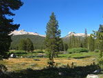
The beginning of the hike near Glen Aulin trailhead. Cathedral Peak amidst the domes in the high Sierra to the south.
The beginning of the hike near Glen Aulin trailhead, the domes in the high Sierra to the south.
East (L) to west panorama in a remote section of Tuolumne Meadows. The river glides like a snake through the middle, rarely more than 3 ft. deep and 100 ft. wide
Leaving the Meadow, the trail enters the forest and emerges in a landscape of granite
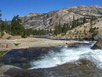
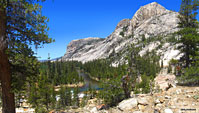
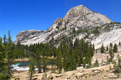
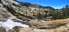
The mountains, the hills, the ground - even the river bed - are all solid granite. Little drops in elevation create gurgling cascades and swirling pools
The mountains, the hills, the ground - even the river bed - are all solid granite. Little drops in elevation create gurgling cascades with swirling eddys
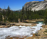
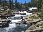
After 3 miles, the descent begins and the river starts sprinting
Over the next 30 miles, the river will drop almost 3000 ft. Looking west from above Tuolumne Falls
Over the next 30 miles, the river will drop almost 3000 ft.
Looking west from above Tuolumne Falls
The first big drop is thundering Tuolumne Falls.


Northwest from below Tuolumne Falls
Northwest from below
Tuolumne Falls
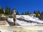
Looking back east to Tuolumne Falls from downstream. A videographer is setting up on a spot where I'd just stood.
The river (bottom right) picks up snow melt from numerous surrounding high ranges. View north from west (L) to east (R)
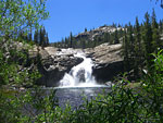
Glen Aulin Falls, just up river from the Glen Aulin High Sierra Camp
The Tuolumne west below  Glen Aulin
The Tuolumne west below
Glen Aulin
You can hear the big noisy drops before you can see them
Granite giants rise up from both sides of the river
This hike delivers the Sierra in its full glory
View west
View west
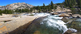
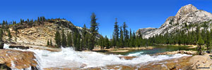
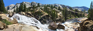
A noisy whitewater cascade surges west under luminous blue Sierra skies. Can't you just hear the sound?
The river slows to catch its breath
At this wide, tranquil spot, the Tuolumne gathers energy for the next plunge. Probably not a good spot to launch the boat...
This next dramatic waterfall features an abrupt 90 degree turn mid-cascade where a granite ledge protrudes into the river
The corralled river slams into the ledge furiously, compacting into a narrow surging channel. A pair of dayhikers (L) observe the drama.
Released from the constraints of the channel, the Tuolumne explodes into a white water torrent and races down the mountain
Looking back east from below.  This fall may be California Falls
Looking back east from below.
This fall may be California Falls
Colorful ancient conifers complement the stone and skyColorful ancient conifers complement the stone and sky The river grows wide during a brief respite before the next drop
The river grows wide during a brief respite before the next drop
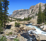
Another energetic waterfall as the Tuolumne descends from east (L) to west (R)
Another energetic waterfall as the Tuolumne drops
from east (L) to west (R)
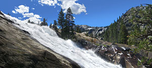
After descending a steep grade, the first glimpse of LeConte Falls from above. The rushing water slams into deep pits, shoots vertically into the air and falls back on itself, giving the impression of turning "water wheels"
Looking down LeConte.
The deep valley west below LeConte from the top of the fallsThe deep valley west below LeConte from the top of the falls Impressive mid-summer, imagine this flow almost doubled with Spring snow melt
Impressive mid-summer, imagine this flow almost doubled with Spring snow melt
 
LeConte Falls, one of the wonders of the Grand Canyon of the Tuolumne River
3/4 mi. below LeConte, another equally impressive cascade - Waterwheel Falls
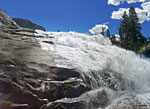
The river leaps over the cliff and slams down into submerged pits, creating more "water wheel" effects, then roars into a narrow channel.
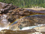
Mini-rainbow in the channel below Waterwheel
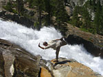
With skillful down-climbing, you can inch your way right up to the base of this thundering bad boy
Several miles downriver, the flow is relaxed again. That's the trail traversing the slanted slope at left
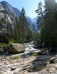
The river twists and turns through high canyon walls
Looking back east up the canyon, on the the climb to bypass impassable Muir Gorge. The canyon up is to the left. Avalanche chutes stripe the mountain at right
At the highest point of the bypass trail, you can climb to the domed summit to get this glimpse into Muir Gorge
At the western base of the Muir Gorge bypass by a bridge, this waterfall from a tributary stream
I waited for the clouds to move to capture the emerald colors
Looking back toward the high ridges above Muir Gorge
Long shadows in the late afternoon
Evening settles in along the trail (R) in the Grand Canyon of the Tuolumne
 
Morning of day 3 from my camp beside this energetic cascade
The water assumes the emerald color of the mineral-laden stream bed
Towering peaks in Pate Valley
 
The big drop falls are behind me but plenty of lively waterworks await discovery
One of the last riverside segments of the trail
Northeast back to the canyon from the strenuous climb up to White Wolf
About halfway up, an easy-to-miss overlook is the only clear view of Hetch Hetchy. There are no trails near the water in this part of Hetch Hetchy.
 
Last look back northeast to the GC of the T
High on the mountain again, the trail passes through lush forest
  More photos in
the Trip Report
top of page
 

TOPHikes Index

Since 11.09